Original hand-coloured historical map of Asia  by Jodocus Hondius
Scroll to zoom, click for slideshow

Original hand-coloured historical map of Asia 1630 - 1631

Jodocus Hondius

Papel
37 ⨯ 50 cm
€ 1.450

Inter-Antiquariaat Mefferdt & De Jonge

  • Sobre la obra de arte
    EARLY DUTCH MAP OF ASIA “Asiae Nova Descriptio Auctore Jodoco Hondio.” Copper engraving made in 1628 by Jodocus Hondius for the "Atlas sive cosmographicæ meditationes de fabrica mundi et fabricati figura", here in a third state published in Amsterdam in 1630/31. Original hand-colouring with later additions. Size: 37.5 × 50.2 cm. This richly decorated map of Asia is among the most influential maps of the early seventeenth century. Its image reaches far beyond the continent itself: the map extends across the Pacific Ocean, showing the Philippines, New Guinea, and even part of North America. While the interior of Asia is still largely filled with names and geographical features that hark back to classical and medieval sources such as Strabo, Ptolemy, and Marco Polo, the coastlines reflect the most up-to-date information from late sixteenth-century Dutch cartography. The Indian subcontinent is drawn with remarkable accuracy based on the new sea charts published in Jan Huygen van Linschoten’s Itinerario (1596). In the north, Willem Barentsz’s discoveries around Nova Zembla are included and dated. Japan and Korea are depicted in the form already familiar from Abraham Ortelius’ famous 1584 map of Japan: Japan in a recognizable shape, but Korea as a large island. The southeastern part of the map shows Sumatra, the Malay Peninsula, the Philippines, and the Spice Islands in a reasonably reliable form for the time. New Guinea is accompanied by a Latin note stating that “it is not yet certain whether this is an island or part of a great southern continent.” In the northeast corner of the map appears the mythical "Fretum Anian" (Strait of Anian), which according to the Latin text might be the same as Davis Strait. This supposed connection between Asia and North America was thought by some to be the passage to the Northwest Passage. Hondius relates that attempts to explore the area had been made repeatedly, but always in vain: violent storms, the terrifying roar of the sea, and ice-covered mountains made every effort impossible. The map is not only a major geographical update of Gerard Mercator’s earlier map of Asia, but also an aesthetic masterpiece. Jodocus Hondius enriched it with an elegant strapwork cartouche, decorative rhumb lines, five sea monsters, and four ships that lend the map extra splendour. By combining classical knowledge, the latest discoveries, and a Baroque decorative style, this map stands as one of the most beautiful and influential representations of Asia in the seventeenth century. In the text block at the lower left, Hondius adds a concise description of the origins of the world’s peoples: “In Asia our first parents, Adam and Eve, were created by God. After the Flood, Noah’s Ark came to rest on the mountains of Ararat in Armenia, and from this place the world began anew in the following way: Noah had three sons, Shem, Ham, and Japheth. The descendants of Shem occupied the regions near the Euphrates, eastward. Ham went to the areas near the Jordan and the Nile, further southward. Japheth took Asia Minor, toward the west, and from there many nations spread into Europe (...). From these three lineages the principal nations of the entire world took their origin (...).” Price: 1.450,-
  • Sobre el artista

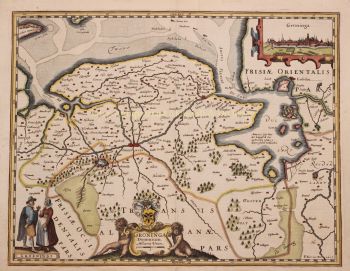
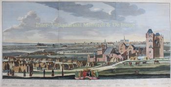
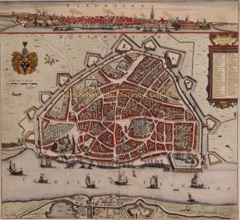
    Jodocus Hondius (17 de octubre de 1563 - 12 de febrero de 1612), también conocido por la forma latinizada de su nombre neerlandés, Joost de Hondt, fue un grabador y cartógrafo flamenco y una de las figuras más destacadas de la Edad de Oro de la cartografía neerlandesa. Para distinguirlo de su hijo, a menudo se le conoce como Jodocus Hondius el Viejo.

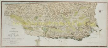
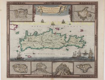
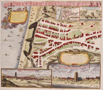
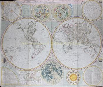
    Hondius saltó a la fama gracias a su excepcional habilidad para combinar la técnica del grabado con la erudición geográfica. Es conocido sobre todo por sus primeros e influyentes mapas de Europa y el Nuevo Mundo, que contribuyeron a moldear la comprensión visual europea de los territorios recién explorados a principios del siglo XVII. Sus mapas se caracterizan por su claridad, precisión y un rico detalle decorativo, cualidades que los convirtieron en documentos científicos de prestigio y obras de arte muy codiciadas.

    Un momento crucial en la carrera de Hondius fue la adquisición de las planchas de impresión originales de Gerardus Mercator. En una época en que la reputación de Mercator comenzaba a decaer, Hondius republicó y amplió estas láminas, integrando sus propias revisiones y los nuevos conocimientos geográficos disponibles. Este acto no solo revivió el legado de Mercator, sino que también consolidó su influencia duradera, dando lugar a los célebres atlas Mercator-Hondius que dominarían la cartografía europea durante décadas.

    Además de la cartografía, Hondius también fue un hábil grabador de retratos. Sus retratos de Francis Drake se encuentran entre las representaciones visuales más reconocibles del famoso navegante inglés, lo que demuestra aún más la versatilidad y el alcance cultural de Hondius.

    Como una de las figuras centrales de la Edad de Oro cartográfica holandesa (c. 1570-1670), Hondius desempeñó un papel crucial en el establecimiento de Ámsterdam como el principal centro de la cartografía en la Europa del siglo XVII. Su obra conectó el arte, la ciencia y el comercio, moldeando la forma en que se cartografiaba, entendía e imaginaba el mundo. Hoy en día, Jodocus Hondius el Viejo es recordado como un maestro grabador, un editor innovador y un arquitecto clave de la historia cartográfica moderna.

¿Está interesado en comprar esta obra de arte?

Artwork details