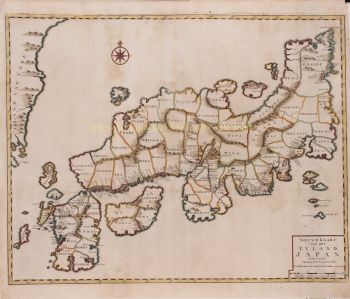
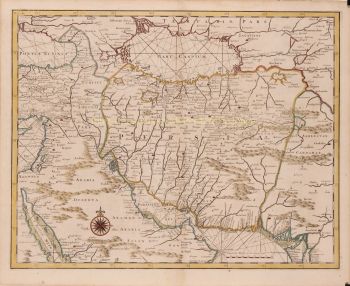
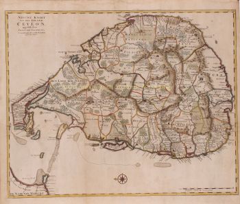
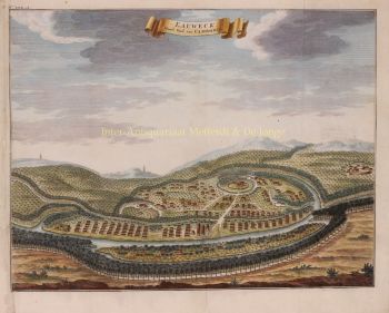
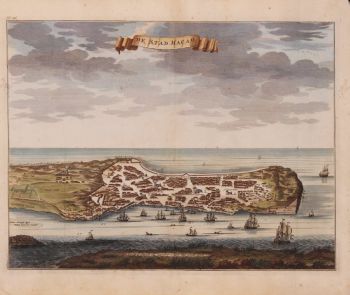
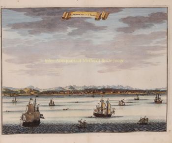
LARGEST ANTIQUE MAP OF JAVA "Nieuwe en Zeer Naaukeurige Kaart van 't Eyland Java Major of Groot Java Verdeeld in Seven Byzondere Bestekken" [new and very accurate map of the island of Java Major or Great Java divided into seven distinct sections]. Copper engraving by François Valentijn, from "Oud en Nieuw Oost-Indiën", published in Amsterdam by Gerard Onder de Linden and Joannes van Braam, 1724–1726. Printed on seven joined sheets. Coloured by a later hand. Size: 45.8 × 174 cm. This extraordinary, nearly six-foot-long map is the most ambitious cartographic depiction of Java produced in the 18th century. Compiled and engraved with remarkable detail, it features the island’s settlements, rivers, roads, agricultural fields, and topography. Along the coastline, detailed nautical features such as depth soundings, anchorages, shoals, and navigational hazards reflect the map’s practical use for maritime navigation. At its heart is Batavia (modern-day Jakarta), the fortified hub of the Dutch East India Company (VOC), depicted in a rare miniature bird’s-eye plan—a visual symbol of its central role in the Dutch colonial network. The map vividly reflects Dutch influence on Java’s landscape and administration. Many place names are rendered in Dutch transliterations or are wholly Dutch in origin (e.g., Ryswyk, Iakatra, Groote Tanjong), superimposing colonial nomenclature onto indigenous geography. Surrounding Batavia are canal systems, rectangular agricultural fields, and structured settlements, which mirror Dutch land use practices and urban planning, adapted to tropical conditions. Numerous fortified VOC posts, marked with red bastions, speak to the Company’s militarized presence across the island. Dutch mapping conventions are also evident, including a Latin compass rose, Dutch mile scale, and a dense network of coastal soundings—attesting to the cartographer’s maritime priorities. François Valentijn (1666–1727), a VOC minister and historian, compiled this map as part of his monumental work "Oud en Nieuw Oost-Indiën" [Old and New East Indies], an encyclopedic account of Dutch exploration, trade, and administration in Asia. Valentijn made two voyages to the East Indies and served as a Calvinist minister in Ambon between 1686 and 1694. Through privileged access to the VOC’s confidential archives, he assembled an unprecedented collection of geographic and ethnographic data—though not always with scholarly integrity. While Valentijn’s maps were considered state-of-the-art in his day, his scholarship, judging by 21st century standards was unscrupulous. Valentyn’s use of the products of other scientists’ and writers’ intellectual labour and his passing it off as his own, reveals a penchant for self-aggrandisement. Nevertheless, this map stands as a landmark of early modern cartography. It captures the intersection of European scientific ambition, colonial authority, and the rich cultural landscape of Java. As both a visual and political artifact, it offers insight into how the Dutch envisioned, recorded, and governed one of their most prized colonial possessions. Price: Euro 3.950,-