World map  by Melchior Tavernier
Scroll to zoom, click for slideshow

Mapa del mundo 1636

Melchior Tavernier

€ 9.500

Inter-Antiquariaat Mefferdt & De Jonge

  • Sobre la obra de arte
    RARE AND STRIKINGLY BEAUTIFUL WORLD MAP “Nova Totius Terrarum Orbis Geographica ac Hydrographica Tabula auct. Iud. Hondio.” Copper-engraved map from the “Théâtre Géographique Du Royaume de France…” published in Paris by Melchior Tavernier, here in its second state of 1636. Coloured by a later hand. Size: 39,0 x 57,5 cm (plus margins). This double hemisphere map is based on Jodocus Hondius' world map of 1617 or possibly Jacob Honervogt's map of 1625, who also followed Jodocus Hondius’map. The ecliptic curves on Tavernier's map are reversed so that the line is north of the equator in the western hemisphere and east of south of the equator in the eastern hemisphere. The map by Hondius was the first to show Le Maire's Straits and the islands in the Pacific discovered by Jacob Le Maire and his explorations in New Guinea. In North America, Hondius' map was also one of the earliest to delineate Hudson's Bay, making special reference to Henry Hudson and the Dutch and English expeditions there up to 1612. Hondius also extends the full course of the St. Lawrence river which now curiously runs across the continent, terminating in a large lake. Decoratively, the map is one of the most attractive. The corners contain scenes of the four seasons. Ver or Spring, shows gardeners tending a formal Dutch garden; Aestas or Summer is the time for sheep-shearing; Autumn brings the grape harvest in for wine-pressing; and in Hyems or Winter skaters revel on a frozen lake. On either side of north and south celestial hemispheres are recumbent figures representing the four elements: Terra, Aqua, Ignis and Aer. The map in the cartouche on the right, is dedicated to the English mathematicians Henry Briggs and Edward Wright. Literature: The Mapping of the World, Rodney Shirley no. 337, plate 230. Price: Euro 9.500,- (incl. frame)
  • Sobre el artista

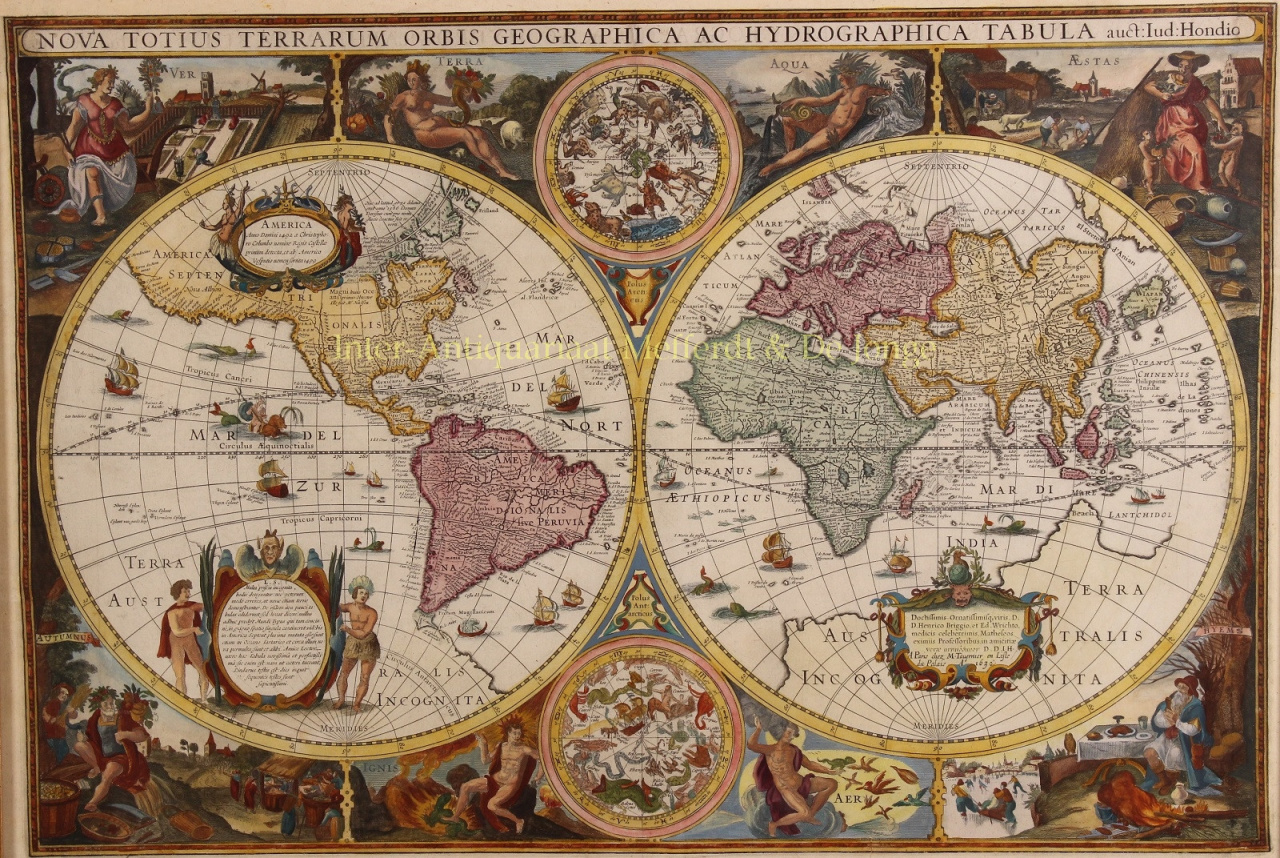
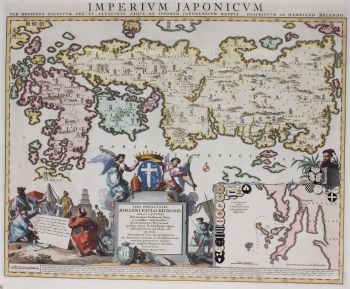
    Melchior Tavernier I (1564 - 1641) fue un grabador francés de ascendencia flamenca. Nacido en Amberes, fue hijo de Gabriel Tavernier y padre de Melchior Tavernier II (1584 – 1665). Es posible que haya estudiado con Ortelius en Amberes.

    A su padre, Gabriel Tavernier, se le atribuye la introducción de la prensa de rodillos en París. Tuvo la distinción de ser Imprimeur en Tailles-douces de la Maison de Sa Majesté. El taller de Tavernier estaba ubicado cerca de Pont Marchand, donde aparentemente varios otros impresores, incluidos Gobert y Collet, también tenían negocios.

    Melchior Tavernier es hermano del célebre escritor y viajero Jean-Baptiste Tavernier (1605-1689). Tavernier grabó varios mapas importantes para personajes como Samuel de Champlain y otros. La obra de Melchior Tavernier II es difícil de distinguir de la de su hijo, Melchior Tavernier II.

¿Está interesado en comprar esta obra de arte?

Artwork details