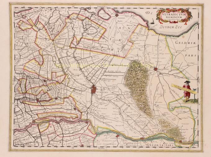
Utrecht / Gooi 1635
Willem Janszoon Blaeu
€ 650
Inter-Antiquariaat Mefferdt & De Jonge
- Sobre la obra de arte
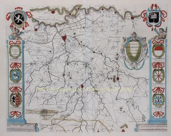
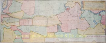
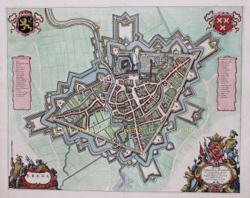
THE HOLIDAY OF UTRECHT "Ultrajectum Dominium". Copper engraving published in 1635 by Willem Blaeu. Verso: French text. Coloured by hand. Sizes 38 x 49,5 cm. Willem Blaeu made this map based on one by Balthasar Florisz. van Berckenrode from 1620. There were no country houses on the Vecht or in 's-Graveland at that time. Monasteries on the Vecht are still depicted, but by then they had already fallen into ruin. This was the time when canals were dug between towns and existing waterways were made suitable for towing ships. In 1599, a towpath was constructed along the Amstel River from Amsterdam to Uithoorn, and between 1626 and 1628 parts of the Amsterdam-Utrecht section were constructed. The first towpaths were constructed as connections between two cities, but in the course of the 17th century more and more separate towpaths were linked. This is how large canal networks came into being. From 1588 (until the French era), the Utrecht District was one of the provinces of the Republic of the Seven United Provinces. What the map does not tell you is that when it appeared, a plague epidemic was raging in Utrecht, which would not stop until 1638. As much as 15 percent of Utrecht's population would die as a result of this disease. Blaeu was inspired to make an atlas like no other in the world. Financial reasons were secondary; the risk was too great for that. But there was rivalry between the publishers of Blaeu and Janssonius and motives such as prestige and display were at least as important. He wanted to create something that would overwhelm the civilised world in the heyday of Amsterdam's power. Out of this ambition appeared the "Atlas Maior". Price: Euro 650,-
- Sobre el artista
"Willem Janszoon Blaeu y su hijo Joan personificaron la 'edad de oro' de la cartografía holandesa. Trabajando durante el siglo XVII, Willem Blaeu dibujó una serie de mapas innovadores y publicó el primer atlas.
Nació en 1571 en Amsterdam y trabajó inicialmente como empleado en el comercio familiar de arenque. Sin embargo, no estaba contento con su ocupación y se fue de casa en 1594 para estudiar matemáticas con Tycho Brahe, el famoso astrónomo. Blaeu fue un buen estudiante que impresionó mucho a su tutor, y cuando completó sus estudios regresó a Amsterdam y estableció un negocio como cartógrafo. Su negocio floreció y su reputación creció. Fue el primer cartógrafo en producir mapas de una sola hoja de muchos países europeos.
En 1605 hizo un mapa mural del mundo, que abarca 20 hojas, cada una de 8 pies de ancho. Este mapa fue, con mucho, el más preciso de la época y contribuyó de manera destacada al conocimiento de la geografía mundial.
Su mapa siguió siendo el más preciso hasta 1648, cuando su hijo, Joan, quien también se convirtió en un famoso cartógrafo, lo actualizó. Pero su mayor logro fue la producción del primer atlas en 1630. El nombre Blaeu era en realidad un apodo familiar que Willem tomó después de que se produjo una confusión entre él y su gran rival Joannes Jansonius.
¿Está interesado en comprar esta obra de arte?
Artwork details
Related artworks
- 1 - 4 / 8
- 1 - 4 / 24
- 1 - 4 / 12

