Mapa del mundo 1587
Abraham Ortelius
€ 5.500
Inter-Antiquariaat Mefferdt & De Jonge
- Sobre la obra de arteONE OF THE GREAT WORLD MAPS OF ALL TIME "Typus Orbis Terrarum." Copper engraving from Theatrum Orbis Terrarum. Published by Arbraham Ortelius of Antwerp from 1587 onwards. With original (?) hand colouring. Size: 35,5 x 48,5 cm. One of the most famous of world maps, from Ortelius' great work, Theatrum Orbis Terrarum. Initially published in 1570, this volume was the first that could truly be called an ‘atlas’ in the modern sense of a compilation of maps engraved to a uniform format according to the most up-to-date information available. The publication of the Theatrum also marked the inauguration of the era of Dutch supremacy in cartography. For these and other reasons, Abraham Ortelius is called the "father of modern cartography." This particular map is based upon Gerard Mercator's large world map of 1569. Ortelius' atlas project had the blessing and aid of Mercator, who supplied Ortelius with coordinates of places in America. Although the map appears rather erroneous to modern eyes, it actually contains some of the best compilation work of the period, which was a hallmark of mapmaking in the sixteenth century. In the north, islands are shown surrounding the North Pole, and separated from America and Asia by a sea passage, the latter being a popular belief in the sixteenth century. In the south, a large "Terra Australis Nondum Cognita" is drawn, separated from South America by the "Estrecho di Magallanes." “From surviving correspondence it is known that Mercator generously encouraged Ortelius to make use of his published corpus of research; he also provided him with coordinates of places in America and perhaps elsewhere.” – Shirley In 1587 Ortelius updated this seminal map for the third and last time. South America now assumes a more accurate shape, and the Solomon Isles are marked for the first time. The updated map is also distinctive and especially beautiful for the four medallions in the corners with classical texts, two from Cicero and two from Seneca. The border of this map is altered as well, now with a more intricate and elegant lattice of strapwork and swag. Altogether with the embellishments, rich colour and important information, one of the great world maps of all time. Literature: “Ortelius atlas maps”, Marcel van den Broecke, Ort3; “The Mapping of the World”, Rodney Shirley, no. 158, plate 130. Price: Euro 5.500,- (incl. frame)
- Sobre el artista
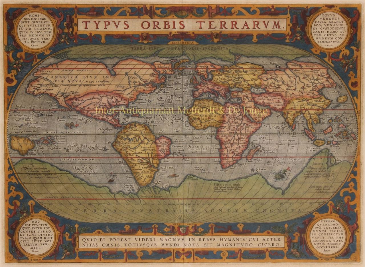
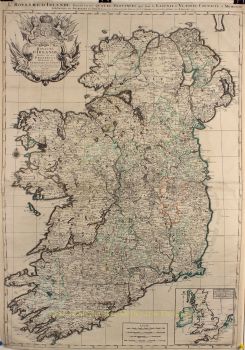
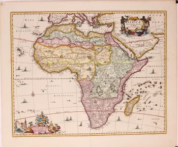
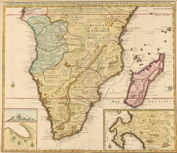
Abraham Ortelius (1527-1598) fue un cartógrafo y geógrafo flamenco, ampliamente reconocido como el creador del primer atlas moderno y uno de los cartógrafos más influyentes de la historia. Su revolucionaria publicación, Theatrum Orbis Terrarum (Teatro del Mundo), marcó un punto de inflexión en la forma de recopilar, estandarizar y presentar el conocimiento geográfico.
Publicado por primera vez en 1570, Theatrum Orbis Terrarum fue revolucionario tanto en su concepto como en su ejecución. A diferencia de colecciones de mapas anteriores, el atlas de Ortelius ofrecía una visión general coherente y sistemática del mundo conocido, con mapas de tamaño, estilo y calidad uniformes, acompañados de comentarios académicos. Este enfoque transformó la cartografía, que pasó de ser un oficio fragmentado a una disciplina científica y cultural estructurada, haciendo accesible la geografía global a académicos, comerciantes y estadistas por igual.
Ortelius vivió y trabajó durante la Edad de Oro de la cartografía neerlandesa, un período en el que los avances en la exploración, la imprenta y el comercio transformaron la comprensión europea del mundo. Junto con Gerardus Mercator, Ortelius es considerado uno de los padres fundadores de la escuela neerlandesa de cartografía. Mientras Mercator revolucionó la proyección cartográfica, Ortelius destacó en la síntesis, reuniendo el mejor conocimiento geográfico disponible en una obra única y de gran prestigio.
Más allá de sus logros técnicos, Ortelius fue un pensador humanista con un profundo interés por la historia, la antigüedad clásica y el intercambio cultural. Mantuvo una extensa red internacional de académicos, exploradores y cartógrafos, citando cuidadosamente las fuentes, una práctica inusual y progresista para su época. Esta integridad académica contribuyó significativamente a la credibilidad y la perdurable influencia de su obra.
El legado de Abraham Ortelius no reside solo en sus mapas, sino también en su visión del mundo como un todo interconectado. Su atlas moldeó la cosmovisión europea durante generaciones y sentó las bases de la cartografía moderna, consolidando su lugar como una de las grandes figuras intelectuales del Renacimiento.
¿Está interesado en comprar esta obra de arte?
Artwork details
Related artworks
- 1 - 4 / 6
- 1 - 4 / 24
- 1 - 4 / 12


